Creation Date: Prior 21/06/05
Map Ref: SP576011
Crop: Barley
Reported by: James Bellinger
Image(s): To follow (Click to enlarge images)
Dimensions/Swirl: (Formation to be properly surveyed)
Description and Information:
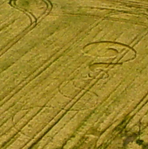
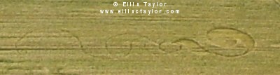
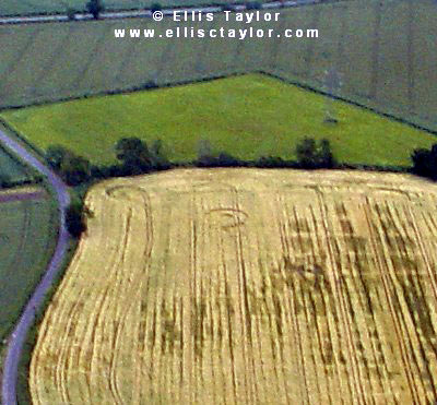
Pictures attached. I'm still away from the computer and internet - had to put these photos on a floppy and send them from a friend's. I flew over the formation this morning. Ground inspection reveals that it has been down for quite a while and following Friday's severe weather the design has deteriorated even more - quite interesting perhaps that the crop around the design's location seems to have been much harder hit. Man (or youth) agency I feel. Pretty, but I didn't get anything special off it, but then it has been down a while. Geoff Ambler plans to survey it as soon as possible. Ellis Taylor
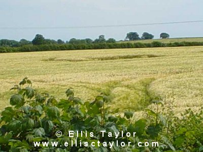
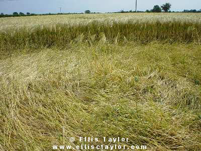
/w circle curving out into various linking pathways. Partly visible from Garsington hill side, looks some weeks old & in poor condition on the ground, i.e alot of animal disturbance. Although impossible to see from the adjacent road it's been well visited as I found close to this on the verge a flattened area with obvious pathways entering into this field.
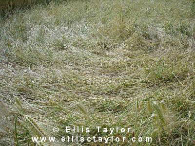
I attempted a survey in late June. The barley was extremely tall in this field and had more or less filled in the very narrow passage ways so I could only make a rough estimate of the length being 250ft overall. There was an overall clockwise flow from the top feature which resembled a chemical retort of approx 51ft x 43ft; then looping into a lozenge shape approx 32 ft x 17ft. The formation then rambled along 1ft wide channels before ending in a neat curlicue at some distance.
Geoff Ambler